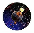
THE POSITIONS OF ALL OBJECTS IN SPACE are measured according to specific celestial coordinates. The best way to understand the cartography, or mapping, of the sky is to recall how the ancient philosophers imagined the universe was shaped. They had no real evidence that Earth moves, so they concluded that it was stationary and that the stars and planets revolve around it. They could see the stars wheeling around a single point in the sky and assumed that this must be one end of the axis of a great celestial sphere. They called it a crystalline sphere, or the sphere of fixed stars, because none of the stars seemed to change their positions relative to each other. The celestial coordinates used today come from this old-fashioned concept of a celestial sphere. The starry (celestial) and earthly (terrestrial) spheres share the same coordinates, such as a north and south poles and an equator.
Star Trails
A long photographic exposure of the sky taken from the northern hemisphere of Earth shows the way in which stars appear to go in circles around the Pole Star or Polaris. Polaris is a bright star that lies within lOaf the true celestial pole, which, in turn, is located directly above the North Pole of Earth. The rotation of Earth on its north-south axis is the reason why the stars appear to move across the sky.Those closer to the Poles appear to move less than those farther away.
Measuring Altitudes
One of the earliest astronomical instruments is the quadrant. It is simply a quarter of a circle, whose curved edge has been divided into 90 degrees. Other similar instruments include the sextant, which is one-sixth of a circle. By sighting the object through the peep holes along one straight edge of the quadrant, the observer can measure the height, or altitude, of that object. The altitude is the height in degrees (0) of a star above the horizon; it is not a linear measurement. A string with a plumb bob falls from the apex of the quadrant so that it intersects the divided arc. Since the angle between the vertical of the plumb bob and the horizontal plane of the horizon is 90°, simple mathematics can be used to work out the angle of the altitude.
Doing the Math
The apex of the quadrant is a 90° angle. As the sum of the angles of a triangle adds up to 180°, this means that the sum of the other two angles must add up to 90° too.
Where is the Pole Star?
To find a town on Earth, a map is used. To find a star in the night sky, astronomers need to use the celestial coordinates. The Pole Star is one useful marker in the northern hemisphere because it indicates the northern celestial pole. Since the north-south axes of both Earth and the sky run at right angles to the terrestrial and celestial equators, which are measured as 0°, the Pole Star is measured as 90° North. An observer looking at the Pole Star near the Arctic Circle sees it very high in the sky; near the equator, the Pole Star barely rises above the horizon. In the South Pacific, it is never seen at all. See the pictures here.
Measuring Time
With solar time, one day equals the time it takes Earth to make one full rotation on its axis, from noon to noon. But because Earth is also orbiting the Sun as well as spinning, the solar day is not accurate in relation to distant stars, and it is the stars that concern astronomers. They measure time time in relation to a distant star. This" day" is the time that passes between two successive "noons" of a star, noon being the moment when that star passes directly over the local meridian (p.27). This is called a sidereal day.
The Celestial Sphere
This model of the celestial sphere records how the ancients viewed the universe. All the planets seemed to travel along the same band as the Sun. Since eclipses happened along this path, it was called the ecliptic. The ecliptic seemed to run at an angle of 23'h° from the plane of Earth's equator. When the Sun passed along the ecliptic, it turned back as it passed through the signs of Cancer in the north and Capricorn in the south. These points where the Sun turned in its path were called tropics.


